

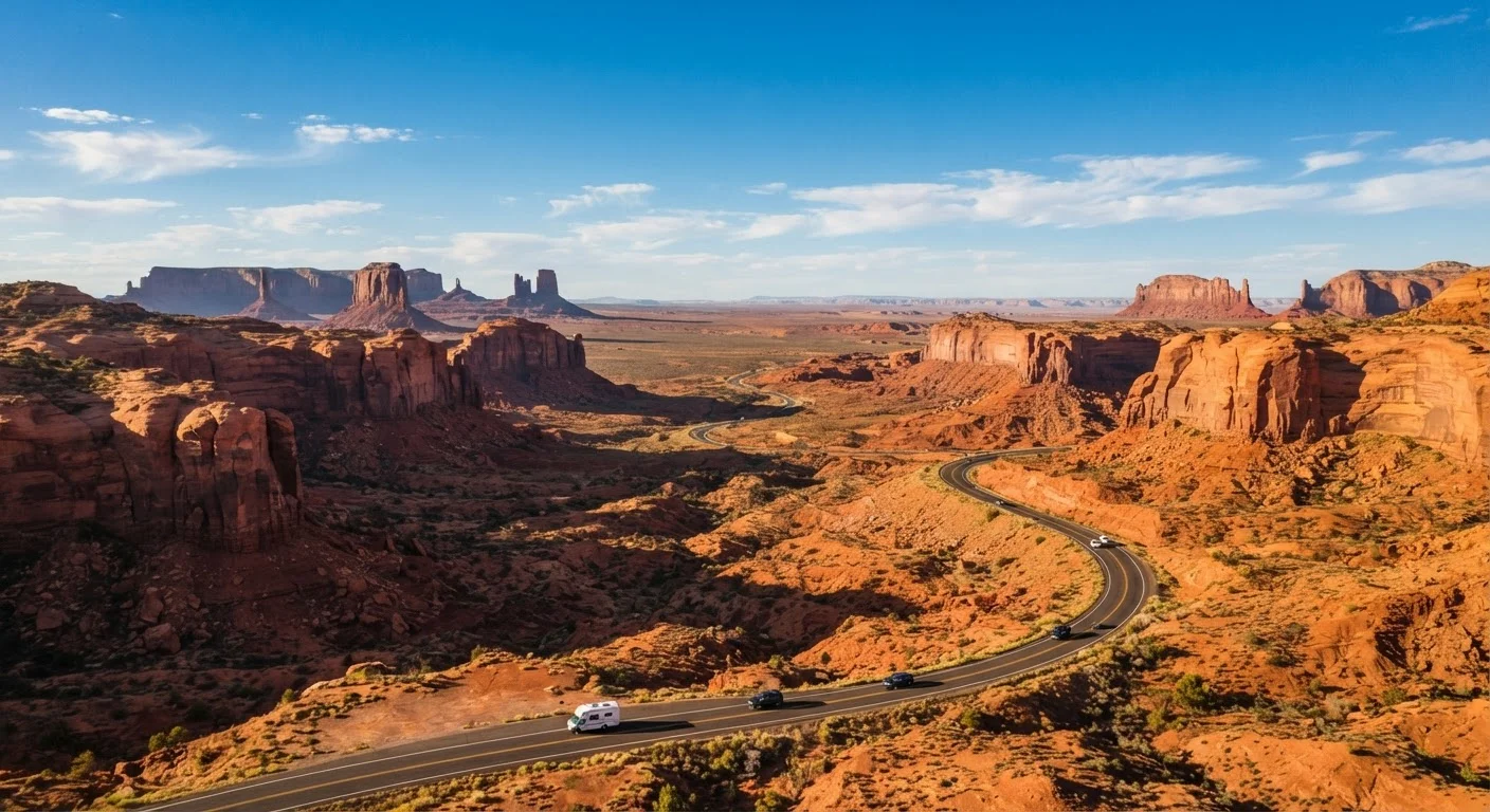
Why the Southwest Rewards Careful Planning
Few regions in the United States pack as much visual drama into a single road trip as the American Southwest. Red rock arches, slot canyons, high-desert plateaus, and ancient ruins sit within driving distance of each other across Arizona, Utah, Nevada, New Mexico, and Colorado. But that grandeur comes with real logistical demands: vast empty stretches, extreme seasonal temperatures, and some of the most in-demand national park permits in the country.
Planning ahead doesn't dampen the adventure - it protects it. Travelers who map their route, secure lodging in gateway towns, and understand the fuel and water realities of canyon country arrive ready to enjoy rather than scramble. Whether you're a first-time Southwest explorer or returning after years away, a structured approach ensures that the landscapes stay breathtaking and the trip stays manageable.
What you will need
What You'll Need Before You Start
A successful Southwest road trip rests on having the right tools in hand before you turn the first key. Beyond your vehicle and travel funds, the resources below will do the heavy lifting on reservations, navigation, and safety. Review them before beginning the planning steps.
National Park Service Website (nps.gov)
Check entry fees, timed-entry permit requirements, camping reservations, and seasonal road closures for every park on your route.
Recreation.gov
Reserve campsites, backcountry permits, and timed-entry passes at federal recreation areas well in advance.
Paper or digital road atlas
Provides a reliable backup navigation reference when cell service disappears on remote desert highways.
Portable water cooler or jugs
Stores extra drinking water for stretches between towns where gas stations and services can be 50+ miles apart.
Offline maps app (e.g., downloaded area maps)
Enables turn-by-turn navigation without cell signal in canyon country and remote park roads.
America the Beautiful Annual Pass
Covers entry fees at national parks and federal recreation sites; may pay for itself within two or three park visits.
Step-by-Step: Planning Your Southwest Route
Follow these steps in order - each one builds on the last. Steps 1 and 2 shape your geographic framework; steps 3 through 5 handle the reservations and logistics that are hardest to recover from if left until the last minute; step 6 brings everything together into a workable plan you can actually use on the road.
Choose your anchor cities and overall route shape
Start by picking your entry and exit points. Common Southwest anchors include Las Vegas, Phoenix, Albuquerque, and Salt Lake City - all have major airports and car rental options. Decide whether your route will be a loop (same start and end city) or a point-to-point one-way drive. Loops are easier logistically; one-way trips may involve one-way rental fees but open more geographic variety.
A classic loop from Las Vegas threads through Zion, Bryce Canyon, Capitol Reef, Canyonlands, Arches, Monument Valley, the Grand Canyon South Rim, and Sedona before returning - roughly 1,500 miles. Map this early so lodging availability research has a clear framework.
Set realistic daily driving distances
The Southwest looks compact on a map but is deceptively vast. A reasonable target for most travelers is 200-300 miles per driving day, especially when sightseeing stops, elevation changes, and slower park roads are factored in. Some legs - like the drive between Bryce Canyon and Capitol Reef - involve winding roads where 100 miles takes three hours.
Build at least one or two full rest-and-explore days into every week of travel. This is where the magic of Southwest road-tripping actually lives. Trying to hit six parks in four days is a recipe for exhaustion rather than wonder. See our guide to managing multi-city road trips for strategies on pacing longer itineraries.
Research and reserve lodging by zone
Southwest lodging falls into a few broad categories: gateway-town hotels and motels (Springdale for Zion, Moab for Arches, Tusayan for the Grand Canyon), in-park lodges (limited rooms, book months in advance), campgrounds (many require Recreation.gov reservations), and glamping or ranch stays scattered across canyon country.
Work outward from your park days. If you want to be inside Zion National Park at sunrise, book Springdale or the park lodge first - those fill fastest. Budget-conscious travelers will find that staying in slightly larger towns one step removed from the parks (like Kanab, Utah) often yields more availability and lower nightly rates without sacrificing much drive time. For a broader look at lodging strategy, the complete American trip planning guide covers accommodation booking logistics in depth.
Secure park passes and timed-entry permits
Several Southwest parks now use timed-entry permit systems during peak season (roughly spring through fall). Arches National Park in Utah has been among the most notable examples in recent years. Permits are often distributed via Recreation.gov on a rolling advance-booking window, sometimes opening months before your target date.
The America the Beautiful Annual Pass covers entry fees at all national parks and many federal recreation areas - worth calculating against your itinerary. A trip touching four or more parks will likely recoup the pass cost. Check nps.gov for each park's current fee, permit, and closure information before finalizing dates.
Plan for fuel, water, and connectivity gaps
Remote Southwest highways can run 50-100 miles between gas stations. Before each driving day, note the longest gap on your route and check your tank accordingly. Apps that show fuel station locations work well when you have signal, but download offline maps for areas like the Arizona Strip or southern Utah canyon country where coverage disappears.
Carry more water than you think you need - a minimum of one gallon per person per day is a commonly cited baseline for desert environments, though individual needs vary. Cell coverage on many park roads and highways is genuinely absent, not just spotty. A dedicated GPS device or pre-downloaded offline maps are practical safeguards, not luxuries.
Build in flexibility and finalize a day-by-day outline
Once lodging and permits are locked, draft a loose day-by-day outline. Resist the urge to schedule every hour - Southwest road trips regularly reward spontaneity with a hidden canyon pullout or a roadside diner you'd never have found otherwise. Leave at least one full buffer day per week as a flex day for delays, extended hikes, or a detour that sounds too good to skip.
Run through the pre-trip planning checklist to confirm you haven't missed anything from travel documents to emergency contacts. For travelers watching their budget across a long multi-day trip, the Travel on a Budget hub offers strategies for stretching your dollars without compromising the experience.
Shoulder Season Is Often the Sweet Spot
Late September through October and April through early May offer milder temperatures, shorter permit queues, and more breathing room at iconic viewpoints. Spring wildflowers in the desert can be spectacular in a good rain year. If your dates have any flexibility, leaning toward shoulder season often makes the whole trip more enjoyable.
Lodging Nuances Worth Knowing
Southwest lodging has a rhythm that differs from most other U.S. regions. In-park lodges - like those at the Grand Canyon South Rim or Zion - carry a romantic appeal and genuine convenience, but rooms sell out sometimes a year in advance. If those specific properties are on your wish list, start there before anything else.
Gateway towns are the practical workhorse of Southwest travel. Springdale, Utah (Zion's doorstep), Moab (Arches and Canyonlands), and Williams, Arizona (a quieter Grand Canyon base) all offer a range of motel, inn, and vacation rental options. Availability improves noticeably in shoulder seasons - late March to early May and September to early November - when crowds thin and temperatures moderate. Summer brings peak visitor numbers, and some high-elevation areas like Bryce Canyon offer pleasant daytime temps while lower canyon areas can be brutally hot. Winter closures affect some park roads; always verify current conditions on nps.gov before finalizing dates. For solo travelers weighing lodging safety and logistics, our solo travel lodging guide addresses many of the same gateway-town considerations from a solo-travel lens.
Summer Heat in Lower-Elevation Areas Is No Joke
The floor of the Grand Canyon, parts of Zion Narrows, and low desert stretches near Page, Arizona can exceed 110°F in July and August. Rangers frequently close or discourage popular trails during midday summer hours. Check current advisories at each park before hiking and plan strenuous activity for early morning.
The content on this site is for informational purposes only and is not a substitute for professional advice. Always consult a qualified professional for guidance specific to your situation.